Natural Areas within the City of Nedlands
Biodiversity
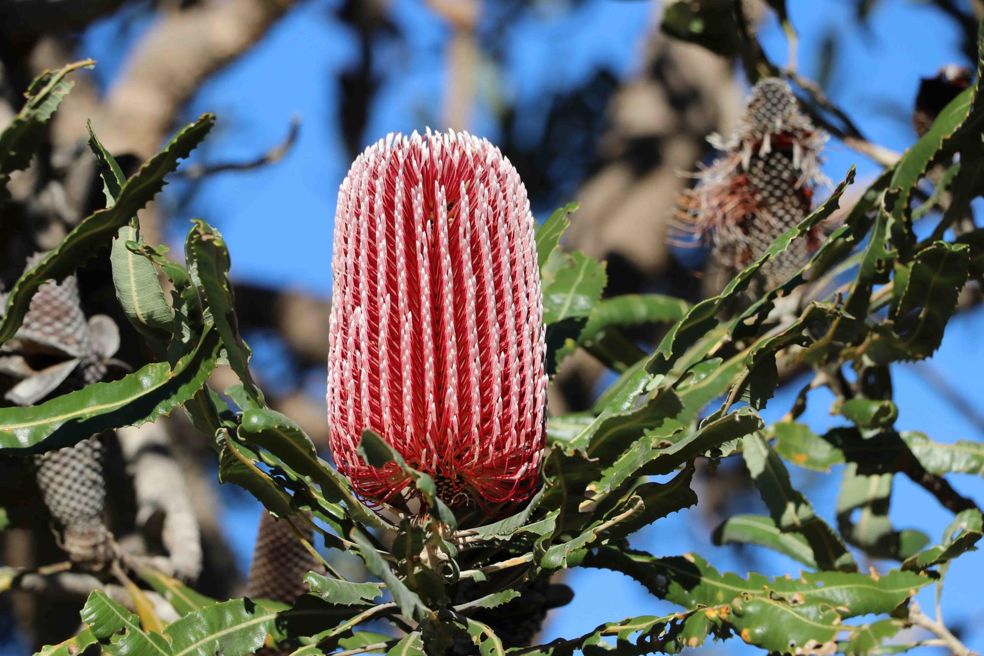
The City of Nedlands contains a vast array of native plants, fungi and wildlife that occur across six key bushland conservation reserves and several small remnant bushland areas and greenways.
These bushland areas are contained within the South-West Botanical Province which forms part of one of the world’s 36 recognised global biodiversity hotspots. A biodiversity hotspot is a biologically rich terrestrial region which is considered to be under threat.
Due to urban influences and past disturbance factors such as inappropriate fire regimes, land clearance, environmental weed invasion, grazing and illegal dumping, these remnant bushlands have suffered disturbance. Furthermore, changing climatic conditions are placing even greater stress on natural ecosystems. The City’s bushland areas, therefore, require ongoing management and protection.
The City collaborates with residents to protect and enhance the region's biodiversity through collaborative bushland management and encouraging residents to plant locally occurring native flora on their properties and Council verges.
Bushland Conservation Reserves in the City of Nedlands
Bushland areas within the City consist of several natural vegetation communities ranging from coastal shrublands and grasslands; Banksia, Marri, Jarrah and Tuart woodlands, and rushlands along the Swan River. These natural areas provide important habitat and ecological linkages as well as offering passive recreation opportunities such as exercise, nature study, photography and bushwalking.
The City of Nedlands is committed to the preservation of our unique and varied bushland areas and has Management Plans for all natural areas. The six key bushland conservation reserves managed in collaboration with the community are:
Shenton Bushland
Shenton Bushland located on Lemnos Street in Shenton Park is a 24.5 hectare bushland (with 21 hectares vested to the City of Nedlands and 3.5 hectares to the Western Australian Department of Health).
The Bushland contains a Bush Forever Site 218 and Banksia Woodlands of the Swan Coastal Plain which is listed as an endangered Threatened Ecological Community under the Environment Protection and Biodiversity Conservation Act 1999 (EPBC Act).
The bushland has significant environmental and heritage values and represents an important greenway corridor between Kings Park and Bold Park. It contains a rich biodiversity of plant, fungi and animal species and and is located on the Bush to Beach trail, one of the six key walking trails along the Whadjuk Trails Network.
The City of Nedlands Environmental Conservation department manages the bushland collaboratively with the Friends of Shenton Bushland in accordance with the Shenton Bushland Management Plan.
Allen Park Bushland
Allen Park Bushland, located in Swanbourne is a 19.1 hectare coastal bushland (with 16.2 hectares vested to the City of Nedlands and 2.9 hectares owned by the Commonwealth Department of Defence).
Allen Park Bushland contains part of Bush Forever Site 315 in the section adjacent to the Indian Ocean along with remnant dune vegetation and 360 degree views offered towards the ocean and Perth Hills. The bushland connects the coastal dunes to inland woodland areas and therefore represents an important greenway corridor.
The bushland has significant environmental and heritage values including a historic precinct containing heritage houses near Wood Street. It contains many native plants, fungi and animal species with significant stands of mature Marri and Tuart trees. It is located on the Bush to Beach trail one of the six key walking trails along the Whadjuk Trails Network.
The City of Nedlands Environmental Conservation department manages the bushland collaboratively with the Friends of Melon Hill Bushland Group in accordance with the Allen Park Management Plan.
Hollywood Reserve
Hollywood Reserve is a 6.5 hectare bushland located directly east of Karrakatta Cemetery between Karella Street and Smyth Road in Nedlands. The bushland consists of remnant bushland including Jarrah, Tuart and Sheoak Open Forest along with a mixture of non-indigenous species. The Reserve includes a grassed parkland area, a bush food garden and a network of pathways. It is divided into two sections by a narrow walkway referred to as the northern and southern sections.
The bushland has significant environmental and heritage values with a vast array of plant, fungi and animal species and is located on the Karak Bidi trail - one of the six key walking trails along the Whadjuk Trails Network.
The City of Nedlands Environmental Conservation department manages the bushland collaboratively with the Friends of Hollywood Reserve in accordance with the Hollywood Reserve Management Plan.
Birdwood Parade Bushland
Birdwood Parade Bushland located in Dalkeith is a 5.7 hectare bushland between the Esplanade and Birdwood Parade in Dalkeith, adjacent to the Swan River.
The bushland represents an important greenway corridor along the Swan River foreshore and has lovely stands of Marri and Banksia trees. It includes the historic Gallop House and Gunners Memorial along with an assortment of native plants, fungi and animal species. It consists of Tuart, Jarrah, Marri and Banksia woodland and is located on the Karak Bidi and Karda Bidi trails, two of the six key walking trails along the Whadjuk Trails Network.
The City of Nedlands Environmental Conservation department manage the bushland in accordance with the Birdwood Parade Management Plan.
Point Resolution Bushland
Point Resolution is located on the northern shores of the Swan River at the junction of Victoria Avenue and Jutland Parade, in Dalkeith. The bushland covers 4.7 hectares and the entire site including the parkland area, is included in Bush Forever Site 221.
Point Resolution contains grassed picnic areas, extensive views of the Swan River towards Point Walter and “White Beach” on the western shore of Freshwater Bay. There are several impressive mature Tuart trees and the bushland forms part of an important greenway corridor along the Swan River foreshore. It has significant environmental and heritage values with a vast array of plant, fungi and animal species and a history of limestone quarrying. It is located on the Bush to Beach trail - one of the six key walking trails along the Whadjuk Trails Network.
The City of Nedlands Environmental Conservation department manages the bushland collaboratively with the Friends of Point Resolution in accordance with the Point Resolution Management Plan.
Mt Claremont Oval Reserve Bushland
Mt Claremont Oval Bushland in Mt Claremont is a 2.2 hectare bushland located to the north of Mt Claremont Oval between Alfred Road and Cleland Street.
The bushland forms a greenway corridor between Lake Claremont and Bold Park and consists of Marri, Jarrah and Tuart trees. The bushland contains several large Macrozamia plants. The bushland has an array of plant, fungi and animal species and is located on the Yange Kep Bidi one of the six key walking trails along the Whadjuk Trails Network.
The City of Nedlands Environmental Conservation department manages the bushland in accordance with the Mt Claremont Oval Reserve Management Plan.
Small Remnant Bushland Areas
There are a number of smaller remnant bushland areas within the City such as Bishop Road Reserve, Waratah Place and Watkins Road along the Swan River Foreshore, that are managed for conservation and wildlife protection. There is also bushland adjacent to Heritage Lane, Pine Tree Park, the Mt Claremont Community Centre, surrounding the Swanbourne High School site and on Cottesloe Golf Club.
These small patches of bushland are considered important greenways as they provide habitat and links to larger bushland areas. The City’s Environmental Conservation department manages these areas for their long-term protection.
Greenway Development Program
Greenways are networks of open space that are maintained or developed for conservation. They are important because they:
- Improve air and water quality;
- Provide habitat and corridors for wildlife;
- Increase biodiversity;
- Reduce erosion;
- Provide examples for environmental education; and
- Demonstrate the importance of local native seedlings that support insect and bird pollinators.
Regional and local greenways within the City of Nedlands have been designated along transport routes where they connect to parkland, remnant bushland and government lands. The connecting parkland, remnant bushland and government lands also form part of the greenway. See where Nedlands greenways are located here.
The City has managed and developed numerous greenways over the years in accordance with the City’s Greenways Policy. Additionally, the City encourages residents to transform their Council verge into a native garden and plant native seedlings on their properties through the annual WESROC Native Plant Subsidy Scheme.